Eupatorium maritimum E.E. Schilling

Detail
- Family
- Asteraceae
- Botanical Name
- Eupatorium maritimum E.E. Schilling
- Common Name
- Maritime Thoroughwort
- Synonym(s)
- Flora of Virginia Name/Status
- Eupatorium maritimum E.E. Schilling
- Comments
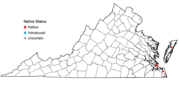
- Eupatorium maritimum is a recently described, hybrid-derived apomictic species that combines genomes from E. mohrii and E. serotinum; see Schilling and Grubbs, Syst. Bot. 41(3) (2016). First documented from "Fortress Monroe, Va." (specimen at US, no date given), where collected by Dr. George Vasey (Reported by George V. Nash in Bull. Torr. Bot. Club 23:3 p.106). This taxon was rediscovered at Little Island in the City of Virginia Beach in 1997, and subsequently at False Cape State Park and on Wallops Island (Accomack Co.). These specimens were initially referred to Eupatorium anomalum Nash, a morphologically similar species that is now known to be an allopolyploid derivative of E. mohrii and E. rotundifolium, and is confined to the South Atlantic and Gulf Coastal Plains. Two additional Virginia specimens (#s 15363, 15364) collected by Fernald from "hollows in sand dunes," Chesapeake Beach (City of Virginia Beach) and determined as "Eupatorium recurvans Small" need re-evaluation, as they are likely Eupatorium maritimum.
According to Schilling and Grubbs (2016), Eupatorium maritimum appears to be restricted to interdune swales in Virginia and the Outer Banks region of North Carolina, and has not been detected either further north or further south. Given its restricted range and habitat, it appears to be a globally rare species.
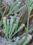
The rhizomes of this species are often suffused with pink (see photos).
- Habitat
- Frequent in saturated interdune swales from Little Island Park, just N of Back Bay NWR south through False Cape State Park; also in an old roadway through dunes on Wallops Island. At False Cape, it often co-occurs with one of its progenitors (E. mohrii), but neither parent is present on Wallops Island.
- Native Status
- Native
To save this map, right-click (control-click for Mac users) on the map and choose "Save Image As...".


