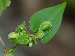
Fallopia cristata (Engelm. & A. Gray) Holub

Show image without county labels
Detail
- Family
- Polygonaceae
- Botanical Name
- Fallopia cristata (Engelm. & A. Gray) Holub
- Common Name
- Crested False Buckwheat
- Synonym(s)
- Polygonum scandens L. var. cristatum (Engelm. & Gray) Gleason; Polygonum cristatum Engelm. & Gray
- Flora of Virginia Name/Status
- Fallopia cristata (Engelmann & A. Gray) Holub.
- Comments
- This taxon has been variously considered a species, a variety of Fallopia scandens (as Polygonum scandens var. cristatum), or a mere depauperate form of F. scandens. FNA subsumes it in F. scandens, stating that "extreme forms are easily identified; some specimens grade gradually into F. scandens, making recognition of F. cristata of questionable utility. S. T. Kim et al. (2000) used morphometric studies as a basis for recommending that F. cristata is best treated as a variety of F. scandens." In Virginia this taxon has proven consistently distinctive enough, both morphologically and ecologically, for recognition at some level. Fallopia cristata occurs in drier habitats than F. scandens, often in association with rocky woodlands, barrens, and outcrops of mafic and calcareous rocks, as well as in somewhat more weedy, dry habitats. By contrast, Fallopia scandens is a plant of mesic to damp, often alluvial forests and thickets. Treatment as a variety of F. scandens seems most appropriate, but the combination is not validly available in Fallopia. Kim and Park proposed this combination, but apparently it was never published; see Tropicos.
- Habitat
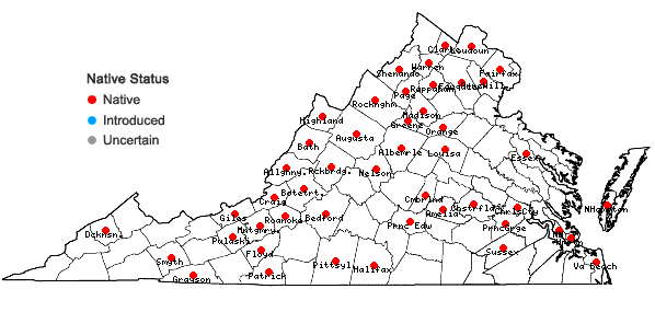
- In the mountains it is often associated with dry, usually rocky open forests, woodlands, barrens, and rock outcrops, most characteristically of mafic and moderately to strongly calcareous substrates; throughout the state range, it also occurs in somewhat more weedy, dry habitats. Frequent in the mountains, excepting southwest Virginia; infrequent in the Piedmont; apparently rare in the Coastal Plain.
- Native Status
- Native
To save this map, right-click (control-click for Mac users) on the map and choose "Save Image As...".

