Spiranthes bightensis M.C. Pace

Show image without county labels
Detail
- Family
- Orchidaceae
- Botanical Name
- Spiranthes bightensis M.C. Pace
- Common Name
- Synonym(s)
- Flora of Virginia Name/Status
- Not in Flora of Virginia; named and described after its publication.
- Comments
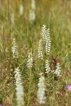
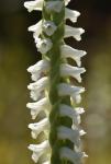
- Recently described by Pace (in Phytotaxa 498(3): 159-176, 2021), this cryptic species is believed to be an ancient, stabilized hybrid between Spiranthes cernua and S. odorata. Physically, it appears largely intermediate between its two putative parents. Per Pace, it differs from S. cernua by its stoloniferous habit (vs. typically non-stoloniferous), generally longer and wider leaves (15-21.4 cm x 1.4-1.7 cm vs. 8.7-20 cm x 0.4-1.1 cm in S. cernua), and fragrant flowers (vs. non-fragrant). However, many populations of unambiguous S. cernua in eastern Virginia produce at least a faint, vaguely floral scent. Conversely, S. bightensis has generally shorter and narrower leaves than S. odorata (15.0-21.4 cm x 1.4.-1.7 cm vs. 13-51.7 cm x 1.8-2.7 cm) and centrally white to pale-yellow or tan labellum (vs. centrally pale to bright-yellow in S. odorata). Virginia's S. bightensis populations produce a moderate to strong general floral scent in contrast with the strong vanilla-jasmine scent of S. odorata; however, Pace suggests some S. bightensis populations produce the vanilla-jasmine scent more typical of S. odorata. Spiranthes bightensis inhabits freshwater to slightly brackish graminoid-dominated wet meadows, interdune swales, and impoundment margins in the narrow maritime zone between Long Island, New York, and the City of Virginia Beach, reaching its southernmost known limits at Back Bay National Wildlife Refuge where it grows in the vicinity of both S. cernua and S. odorata. Several populations are known from the Western Shore of the Chesapeake Bay including one in Virginia in Middlesex County. It almost certainly occurs in northeastern North Carolina but has not yet been vouchered. The Range of S. bightensis is sympatric with S. cernua but not with S. odorata except in Tidewater Virginia. In sum, S. bightensis resembles a slightly smaller-statured S. odorata with less pronounced lip coloration growing in wet, open maritime habitats.
- Habitat
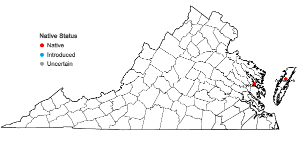
- Known in Virginia from two Accomack County records: a 1991 collection (Zebryk s.n. at GA) from the seepy margins of an old millpond and a more recent photo record from an impoundment at Chincoteague National Wildlife Refuge. Also recently documented from a boggy, open seepage slope bordering tidal wetlands of the Rappahannock River in Middlesex County and from an unvouchered site record along an impoundment at Back Bay National Wildlife Refuge. This species should be sought in similar maritime habitats along the Atlantic Seaboard and on both shores of the Chesapeake Bay.
- Native Status
- Native
To save this map, right-click (control-click for Mac users) on the map and choose "Save Image As...".


